How we helped Altitude by Geotab turn complex freight insights into a simple, engaging tradeshow experience that planners couldn’t ignore.
Altitude by Geotab

Background
Altitude by Geotab provides real-world freight insights to help planners make confident decisions. But like most data platforms, its value isn’t always obvious in a fast-paced tradeshow setting.
Services
- Audience messaging
- Creative strategy, planning & asset creation
- Experiential production liaison
- Landing page content & design
Challenge
Freight planners are used to complex tools and abstract data. At a busy tradeshow, Altitude needed to quickly show how its data cuts through uncertainty and solves real-world congestion challenges.
Human Insight
Planners don’t trust guesses. They trust what they can prove, especially when the stakes are public funding and real-world impact.
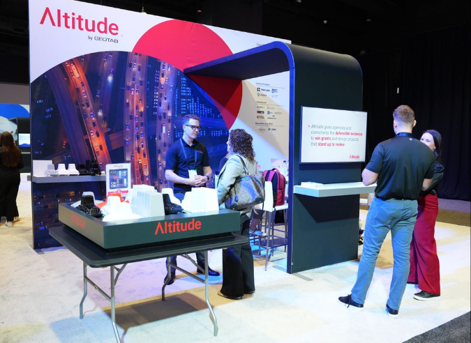
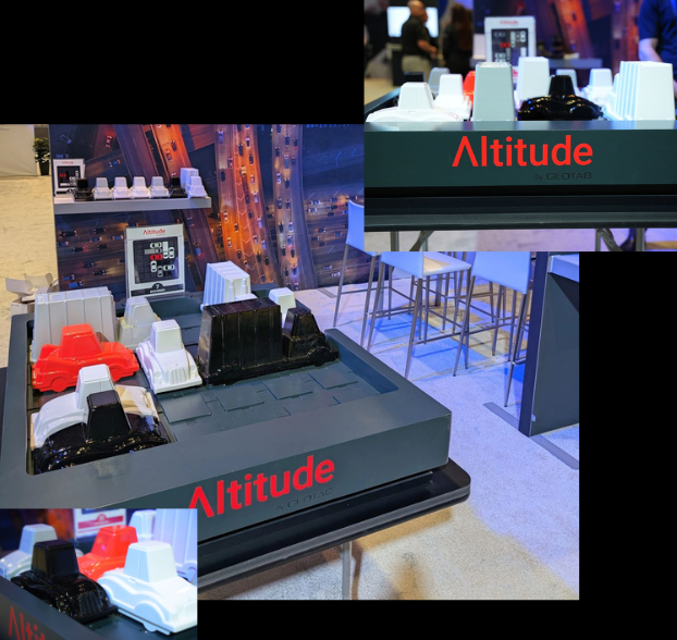
Making Data Tangible (and a Little Competitive)
We turned Altitude’s value into something physical and interactive: a giant, playable version of Rush Hour. The game challenged attendees to solve gridlock in real time—mirroring the decisions planners face every day. It created an immediate, intuitive connection to Altitude’s core value: removing guesswork with real-world freight insights. Timed gameplay, competition, and prizes drew people in, while the experience naturally led to deeper conversations about how Altitude delivers defensible freight insights.
Stopping Traffic: Literally & Figuratively
The activation transformed the booth into a destination. It drew consistent traffic, increased dwell time, and made Altitude’s value instantly clear, turning a complex data story into something people could experience firsthand.